
Second-cycle
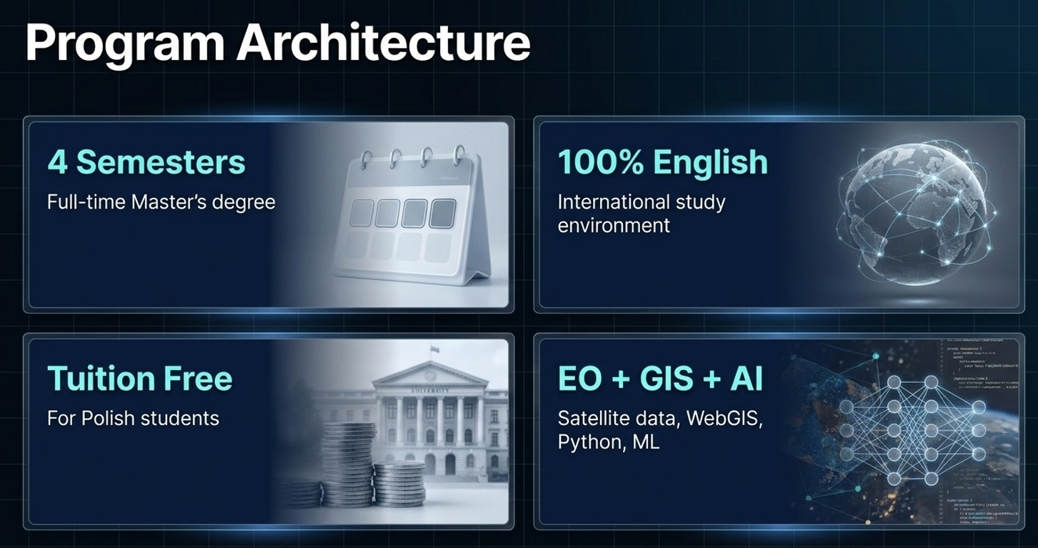
Master’s degree programme, full-time studies.
Overview
Essential programme facts are placed first: degree level, language, duration, study model, fees and the official application path.
Master’s degree programme, full-time studies.
International study environment; programme offered in English.
Start of studies for the summer recruitment intake.
30 ECTS per semester; diploma thesis in the final semester.
Remote Sensing and Geo-Informatics.
AGH University of Krakow.
Faculty of Geo-Data Science, Geodesy and Environmental Engineering.
EUR 1650/semester for foreign students; no fee for Polish students according to programme communication.
Official facts and programme links: AGH Master studies offer and programme page.
Why RSG?
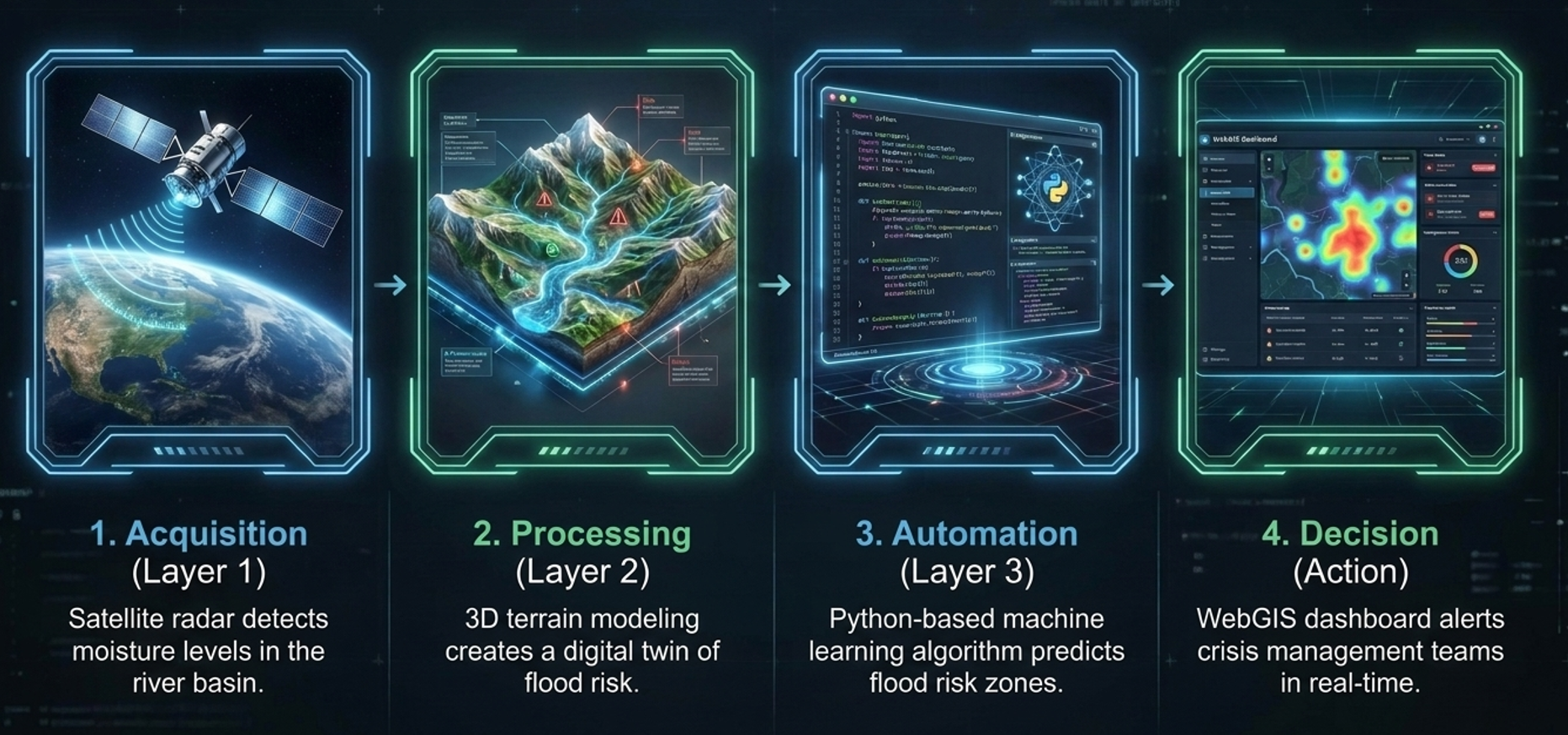
Satellite, UAV, LiDAR and GIS data support environmental monitoring, spatial planning, agriculture and crisis-management decisions.

Study Model
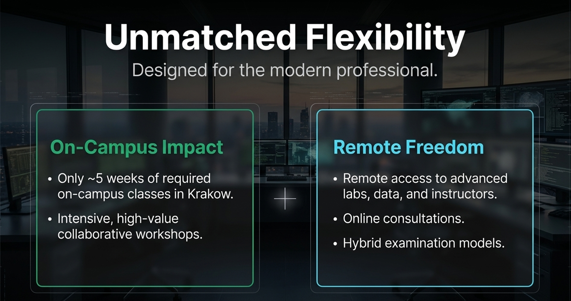
The programme uses large thematic blocks rather than many fragmented courses. It combines online learning with concentrated live classes, workshops and group work.
Teaching is clustered into coherent learning blocks instead of many isolated subjects.
Live classes are concentrated in selected periods, mainly workshops and laboratory work.
Applied tasks, project work and collaborative learning are central to the programme.
Online consultations, data access and hybrid assessment support flexible learning.
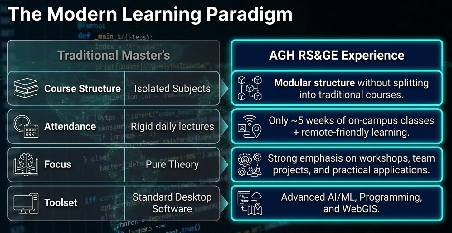
Study model based on the programme description and AGH syllabus.
What You Learn
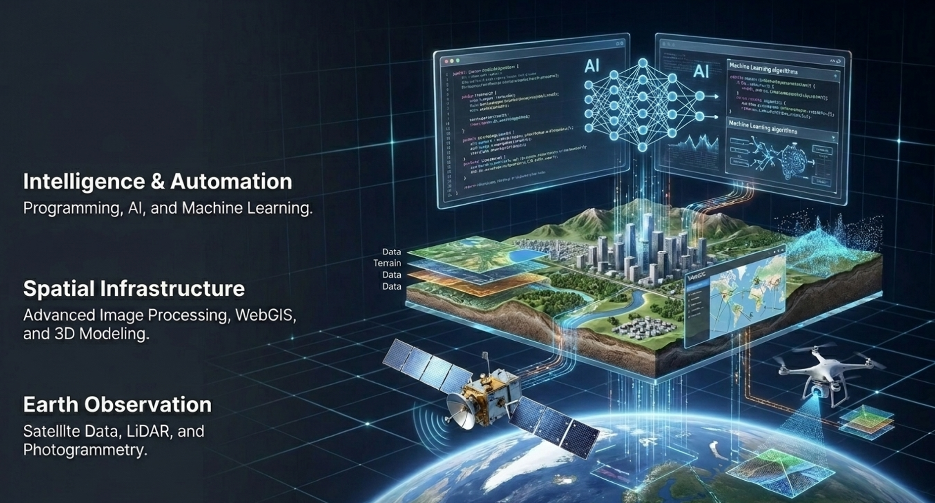
Learning outcomes combine Earth observation, 3D acquisition, GIS, programming, AI and applied environmental analysis.
Satellite data processing; optical, thermal, radar and hyperspectral remote sensing; spectral indices such as NDVI.
Airborne LiDAR, UAV-based data, photogrammetry, point clouds and 3D terrain modelling.
Spatial data infrastructures, WebGIS, Python, R, JavaScript, AI, machine learning and advanced image processing.
Environmental monitoring, change detection, agriculture, urban planning, disaster response and crisis monitoring.


Curriculum
The syllabus is organised across four semesters and ends with a diploma thesis. The learning path moves from data acquisition and processing to modelling, automation and decision-support applications.
| Semester | Main study focus | ECTS |
|---|---|---|
| 1 | Remote sensing foundations, programming, spatial data, image processing and GIS concepts. | 30 |
| 2 | Earth Observation data processing, LiDAR, UAV, photogrammetry, WebGIS and applied spatial analysis. | 30 |
| 3 | Advanced geoinformatics, AI/ML, environmental applications, natural hazards and project work. | 30 |
| 4 | Professional practice, seminar and Master’s thesis. | 30 |
Detailed semester modules should be verified against the official AGH syllabus before publication.
Entrance Exam
Candidates take the online entrance examination in the recruitment cycle in which they apply. Both exam dates are shown below, together with the topic list and a direct link to the example exam PDF.
For candidates applying in the first recruitment cycle. Examination window: 9:00–21:00 CEST.
For candidates applying in the second recruitment cycle. Examination window: 9:00–21:00 CEST.
The example PDF and the official exam page are linked directly from this section.
Official exam information: entrance examination page.

Practice & Research
The programme is practical and project-oriented, with research projects, industry workshops, conferences, internships and thesis cooperation.
Careers
Graduates combine Earth observation competence with geospatial analytics, programming and environmental applications.

Recruitment
Recruitment for full-time Master’s studies is organised in two summer cycles. Candidates submit their declaration in e-Rekrutacja, pay the recruitment fee and take the online entrance exam.
Declaration in e-Rekrutacja: 1 June – 17 July, 10:00 CEST. Online entrance exam: 24 July, 9:00–21:00 CEST. Results: 28 July after 15:00 CEST.
Declaration in e-Rekrutacja: 28 July after 15:00 CEST – 7 September, 10:00 CEST. Online entrance exam: 11 September, 9:00–21:00 CEST. Results: 15 September after 15:00 CEST.
Candidates with Polish higher education diplomas: 30 July – 3 August. Candidates without Polish diplomas: 16–30 September, on working days.
EUR 1650/semester for foreign students; no fee for Polish students according to programme communication. Eligibility and documents should be checked in official rules.

 Programme
 Recruitment
 Exam
ExamOfficial links
All essential external links are grouped in one visible place: programme information, syllabus, entrance examination, example exam, recruitment system, deadlines, fees and documents.
FAQ
Short answers to the questions candidates are most likely to ask before applying.
Yes. The programme is offered in English and is designed for an international study environment.
The model is remote-friendly. Programme communication highlights approximately 5 weeks of live/on-campus classes, focused on workshops and group work.
Yes. The online entrance exam is organised in two recruitment cycles. The official exam page includes topics and an example exam PDF.
Satellite data, optical/thermal/radar/hyperspectral remote sensing, LiDAR, UAV data, photogrammetry, point clouds, GIS, WebGIS, Python, R, JavaScript, AI and machine learning.
Graduates are prepared for public administration, consulting and service companies, industry, spatial planning, environmental protection, agriculture, energy, transportation and scientific research.

Contact
Faculty of Geo-Data Science, Geodesy and Environmental Engineering
AGH University of Krakow
al. A. Mickiewicza 30, 30-059 Krakow, Poland
Programme contact listed in AGH Master offer: Prof. dr hab. inż. Beata Hejmanowska, galia(at)agh.edu.pl.
Department for International Students
E: international.students(at)agh.edu.pl
P: +48 12 617 50 92
Phone: +48 12 617 38 26
Email: ukras@agh.edu.pl
Final step
Use the QR code to go directly to the official AGH recruitment portal.
