Blok modułów specjalizujących: Geoinformatyka, fotogrametria i teledetekcja
Moduły po angielsku, specjalność - must see!
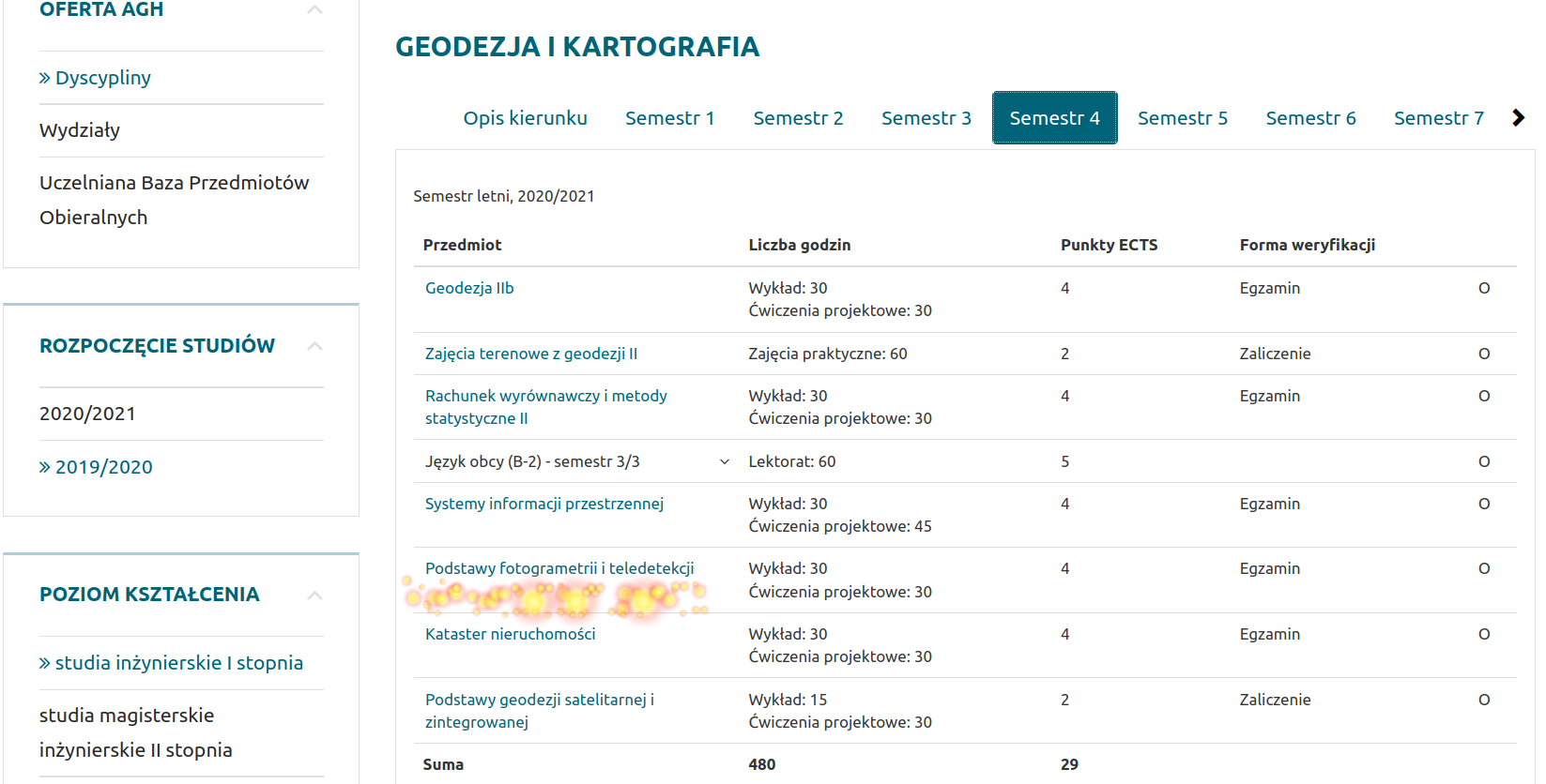
Semestr 4 Podstawy fotogrametrii i teledetekcji - przedmiot obowiązkowy
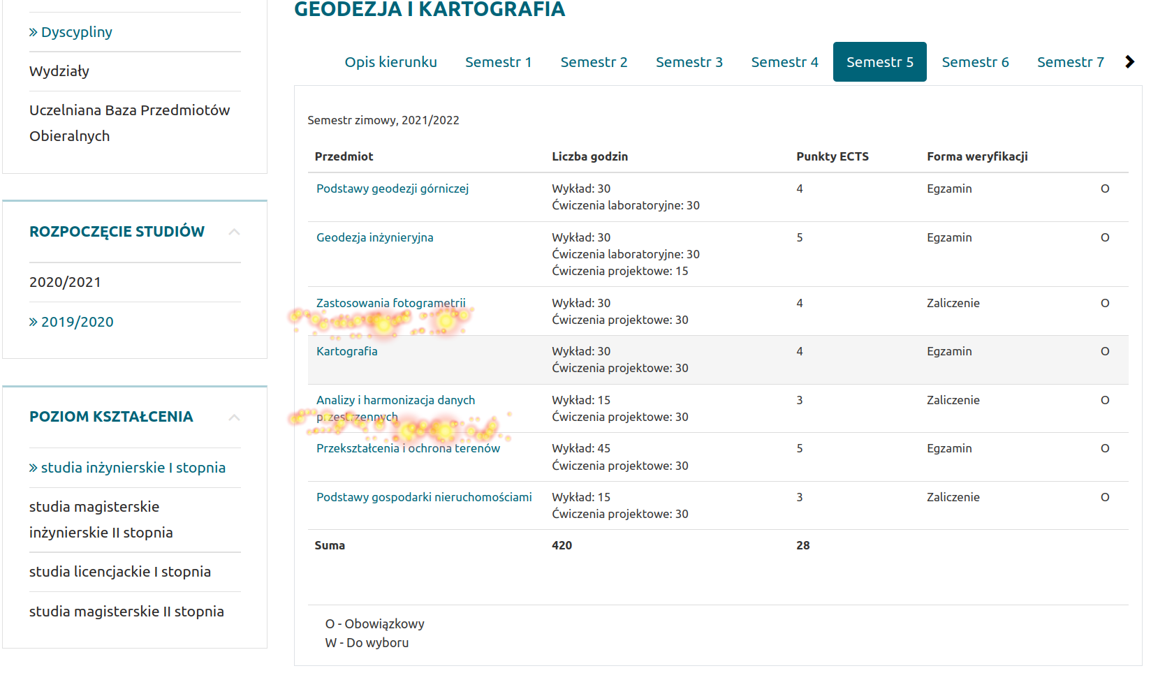
Semestr 5 przedmioty obowiązkowe
Zastosowania fotogrametrii
Analizy i harmonizacja danych przestrzennych
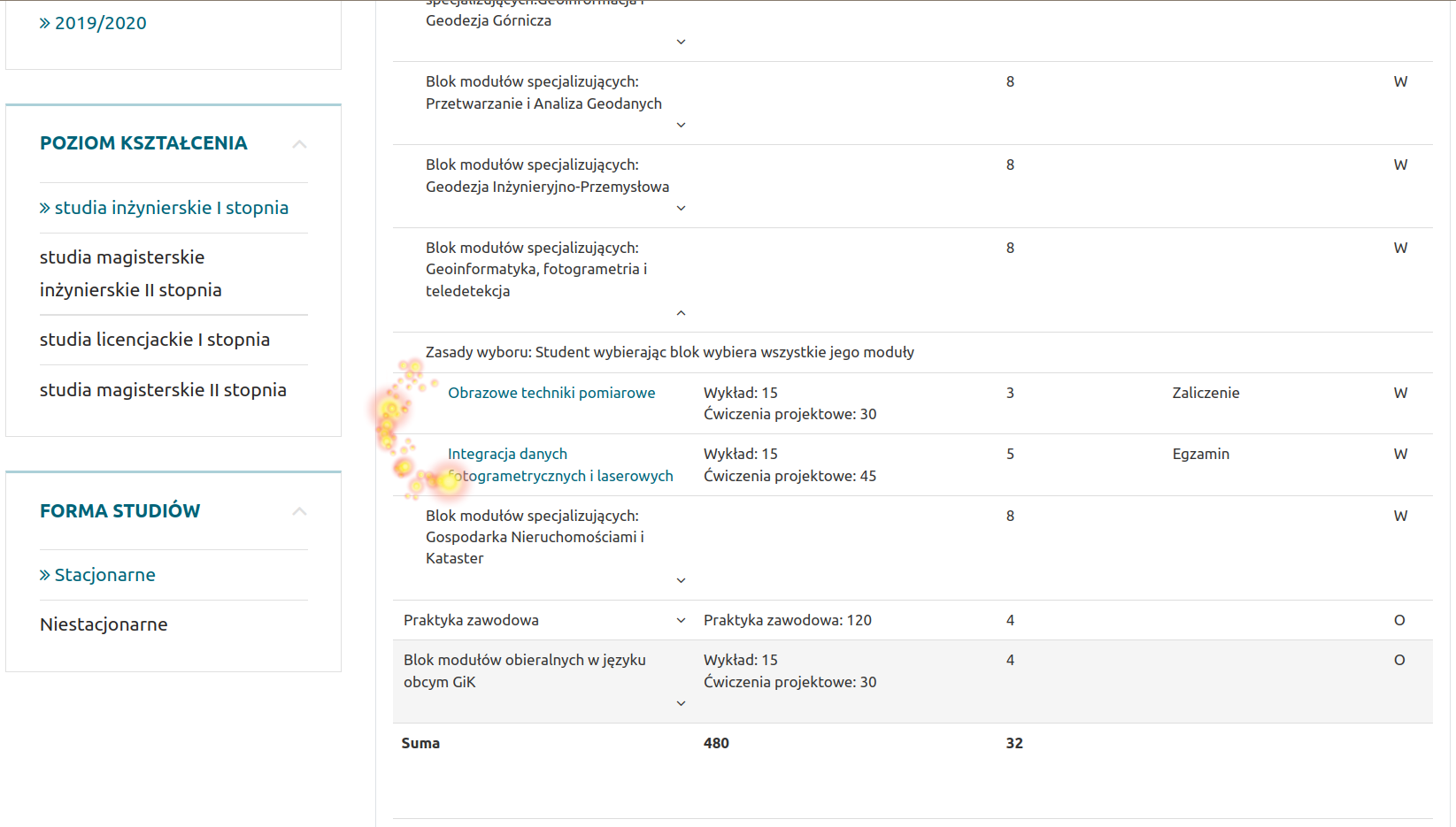
Semestr 6 Blok modułów specjalizujących: Geoinformatyka, fotogrametria i teledetekcja
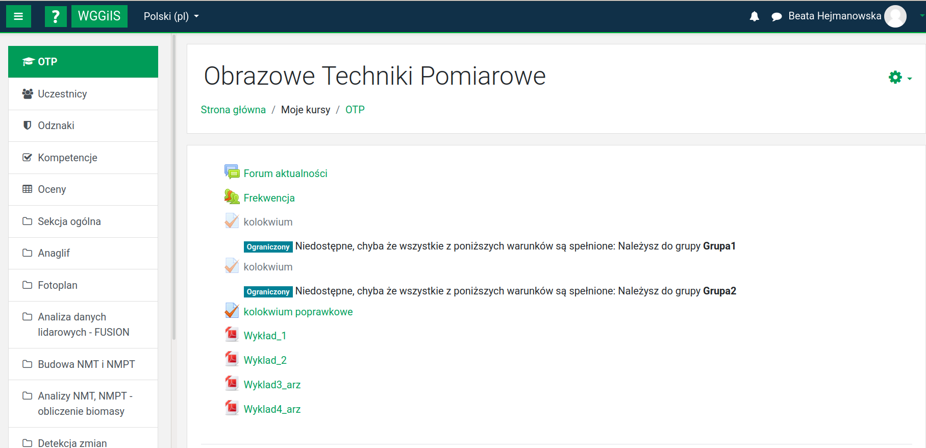
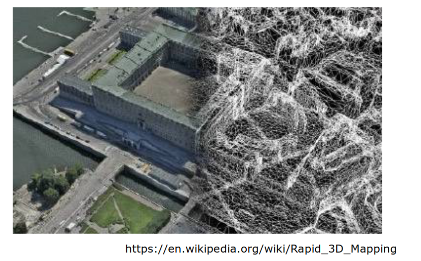
Obrazowe techniki pomiarowe
Integracja danych fotogrametrycznych i laserowych
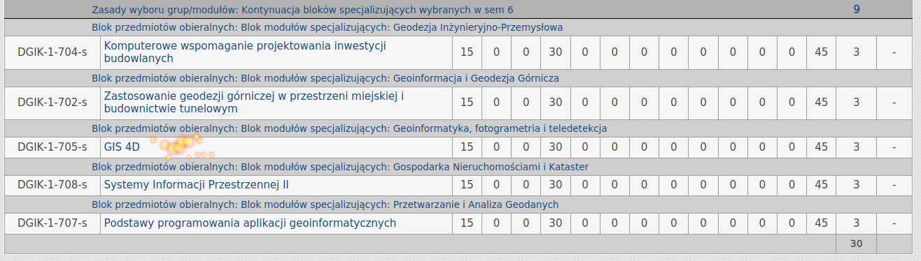
Semestr 7 Blok modułów specjalizujących: GIS 4D

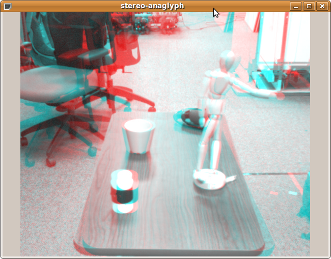
źródło: https://apk-dl.com/stereo-image-editor/com.karapps.stereoimage
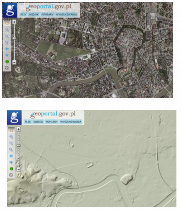
Produkty geodezyjne:
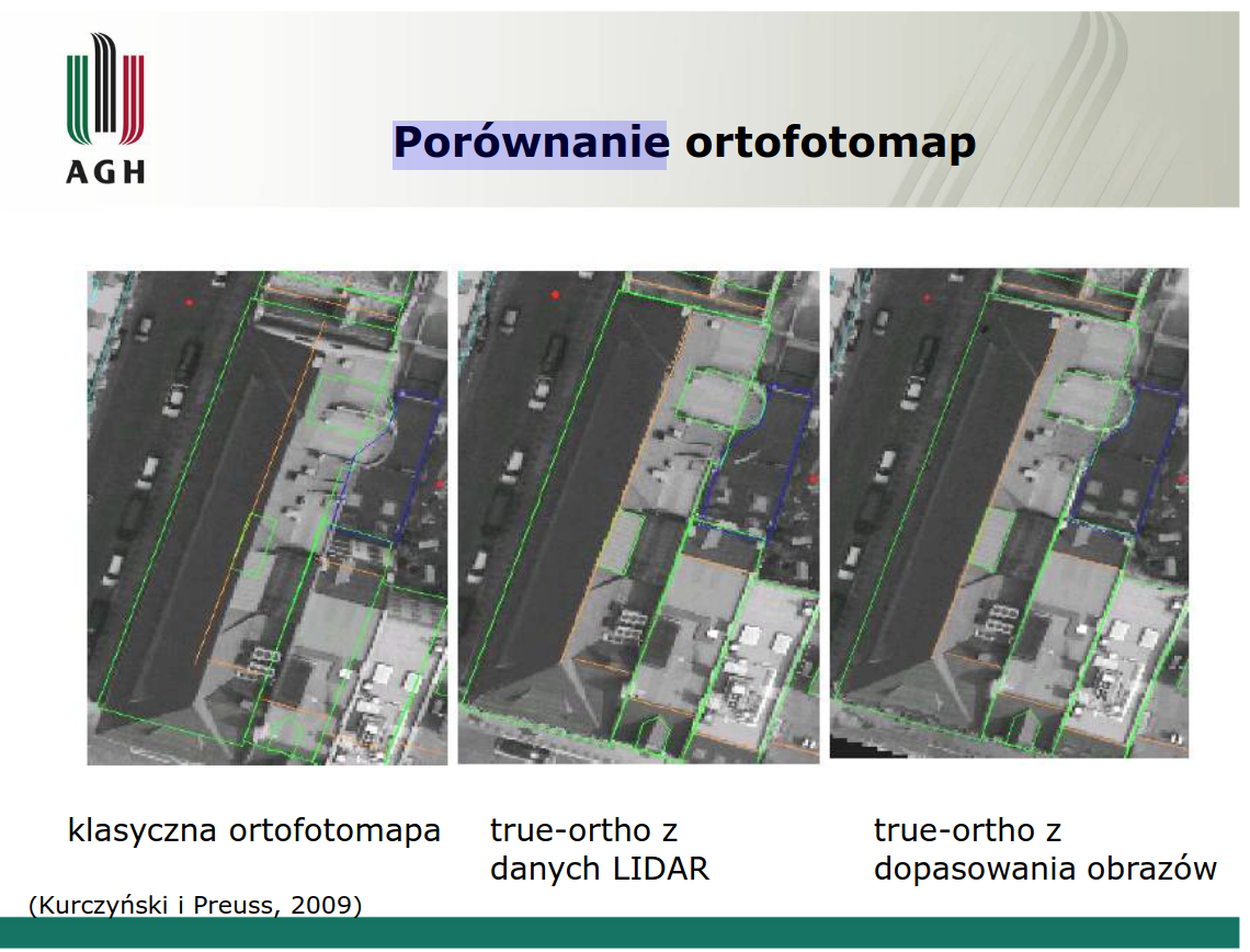
ORTOFOTOMAPA
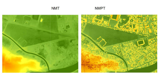
NMT numeryczny model terenu, NMPT numeryczny model powierzchni terenu
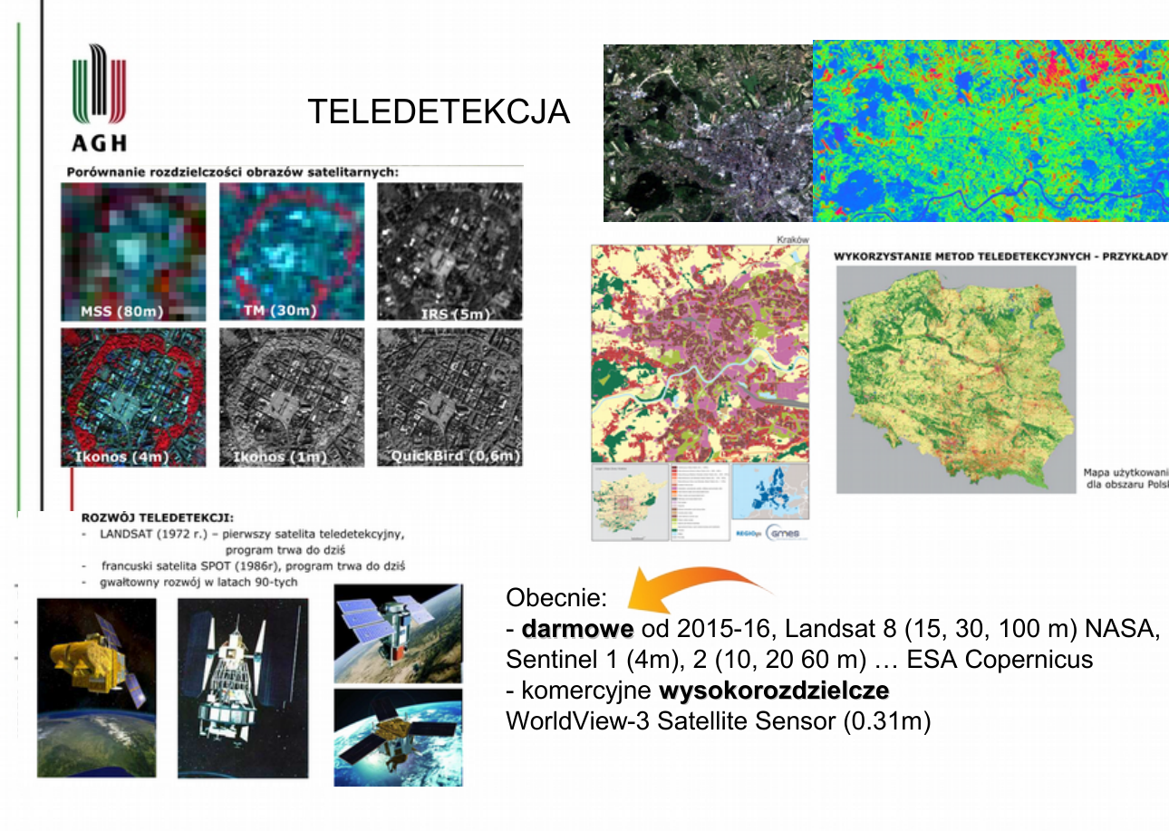
Teledetekcja
Obraz satelitarny RGB
Obraz satelitarny FCC
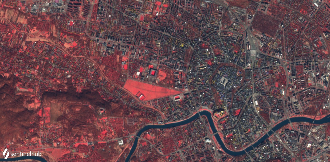
Obraz satelitarny 01.03.2021
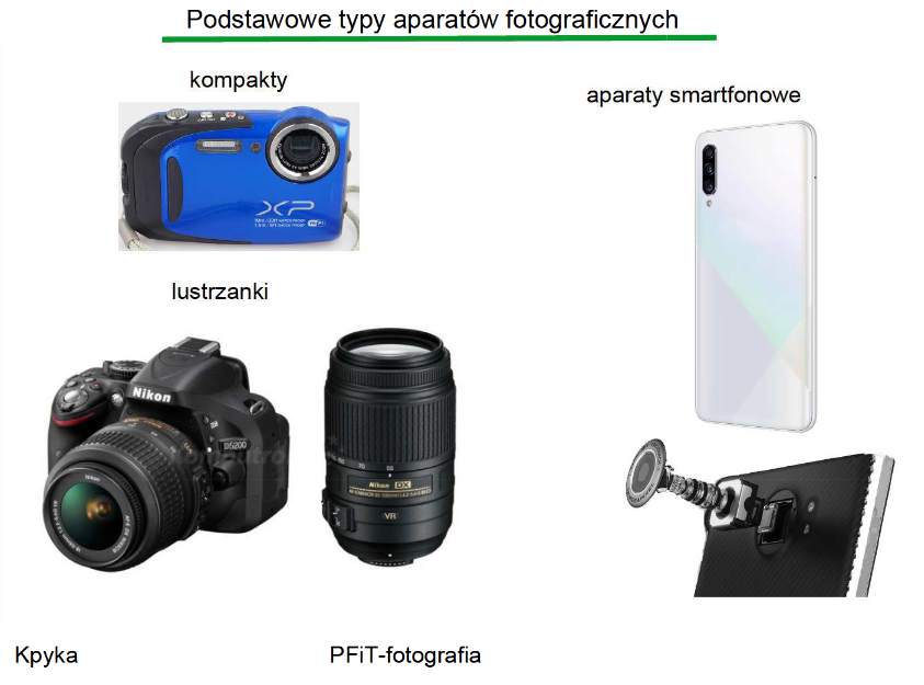
Podstawy fotogrametrii i teledetekcji
Materiały pomocnicze - must see !!!
Semestr 5
Zastosowanie fotogrametrii
Analizy i harmonizacja danych przestrzennych - przedmiot obowiązkowy
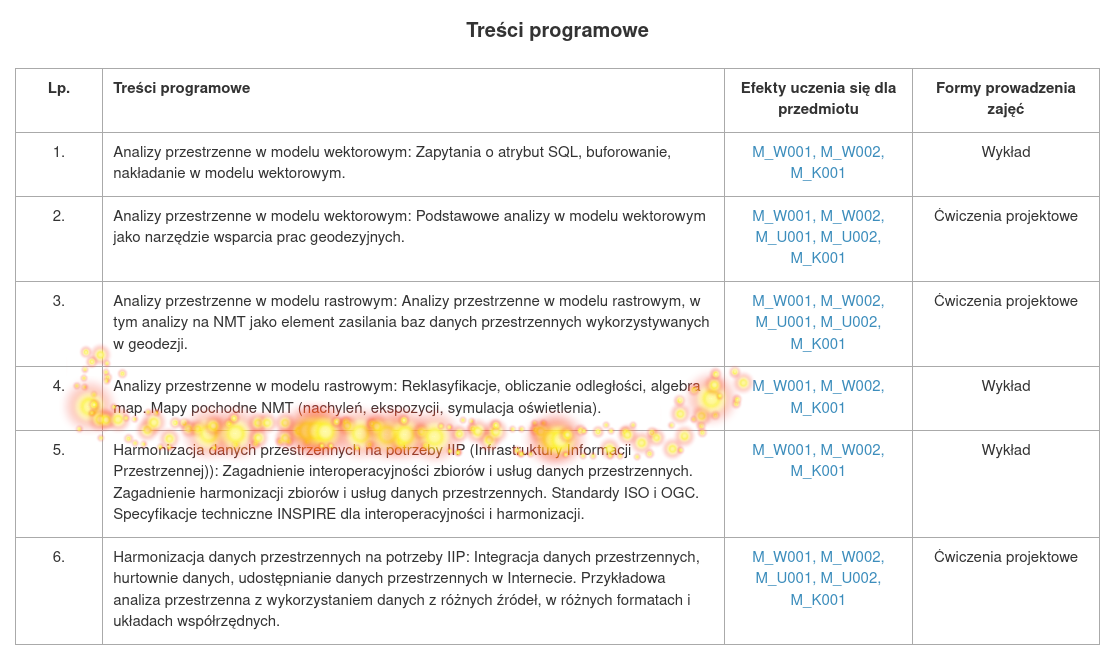
Analizy rastrowe
Raster więcej może ;-)
Image from arcgis.com
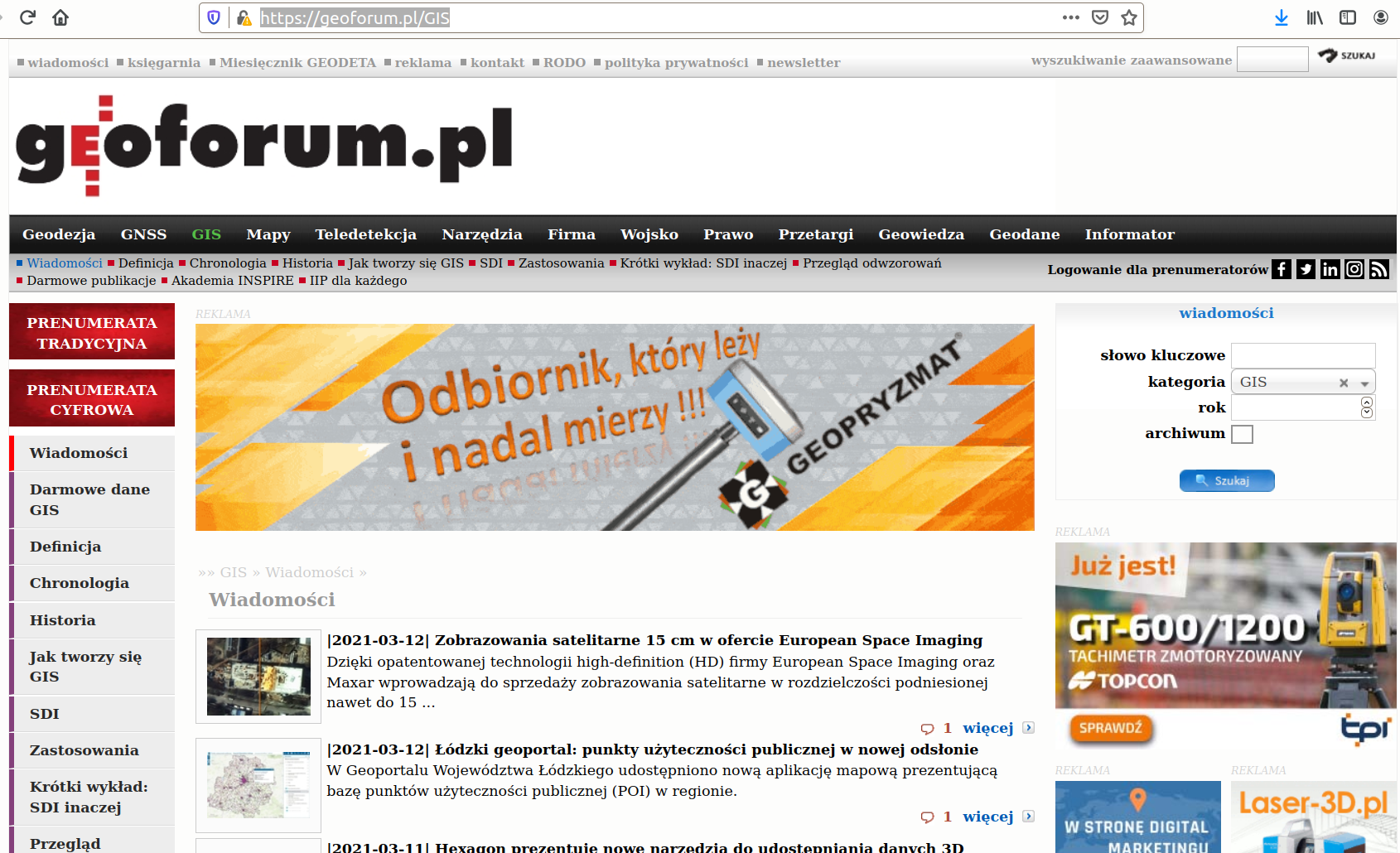
geoforum.pl
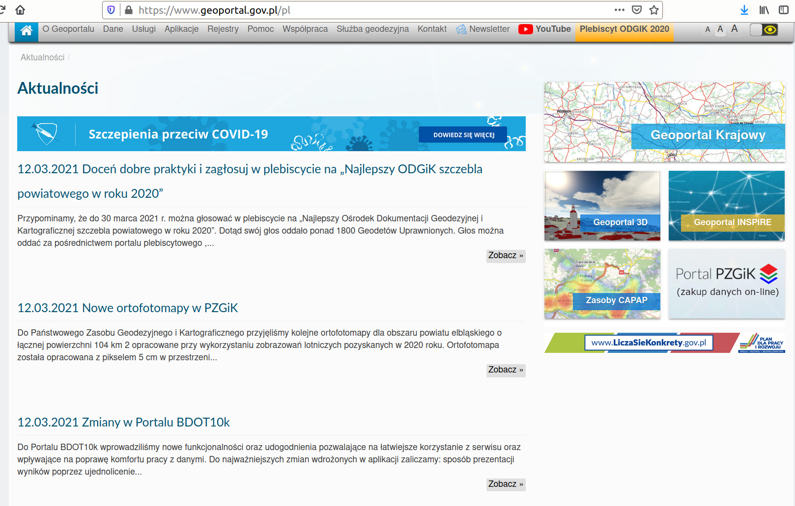
Udostępnianie danych w Internecie
ARCANAGIS
Mapy epidemii wczoraj i dziś marzec 2020
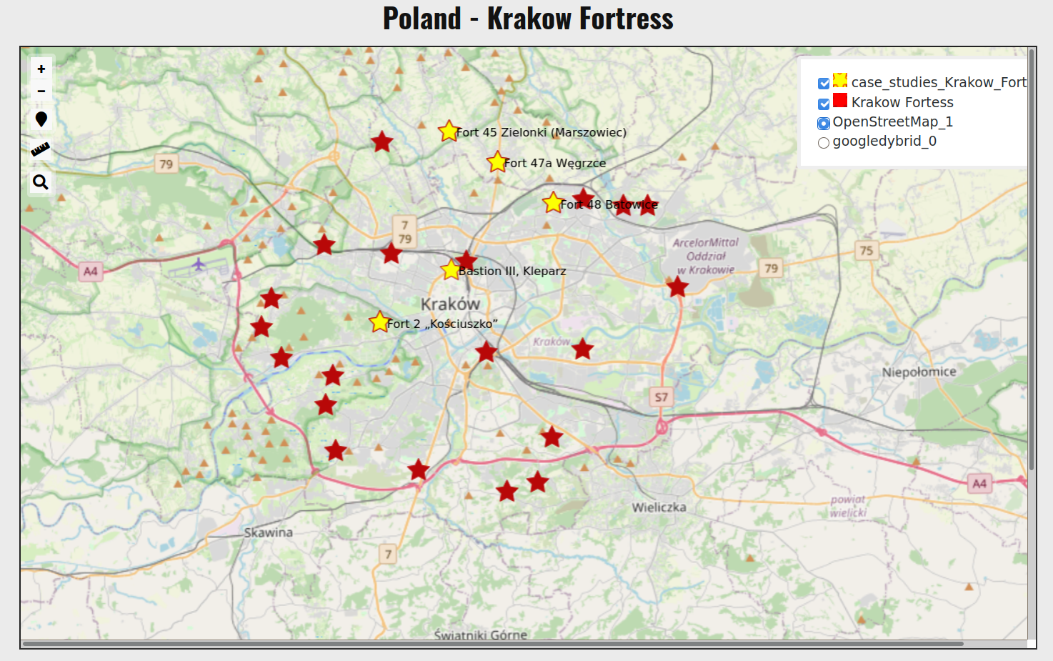
XVII Wyprawa BARI – Jordania 2018
Z nami nie zabłądzisz – geoportal AGH. Jak to robiliśmy?
ARCGIS StoryMaps
Semestr 6 Blok modułów specjalizujących: Geoinformatyka, fotogrametria i teledetekcja
Obrazowe techniki pomiarowe UPEL
Tworzenie NMT/NMPT
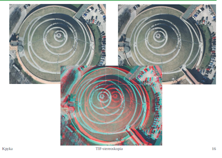
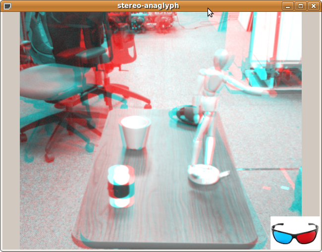
Tworzenie anaglifów
i inne....
-
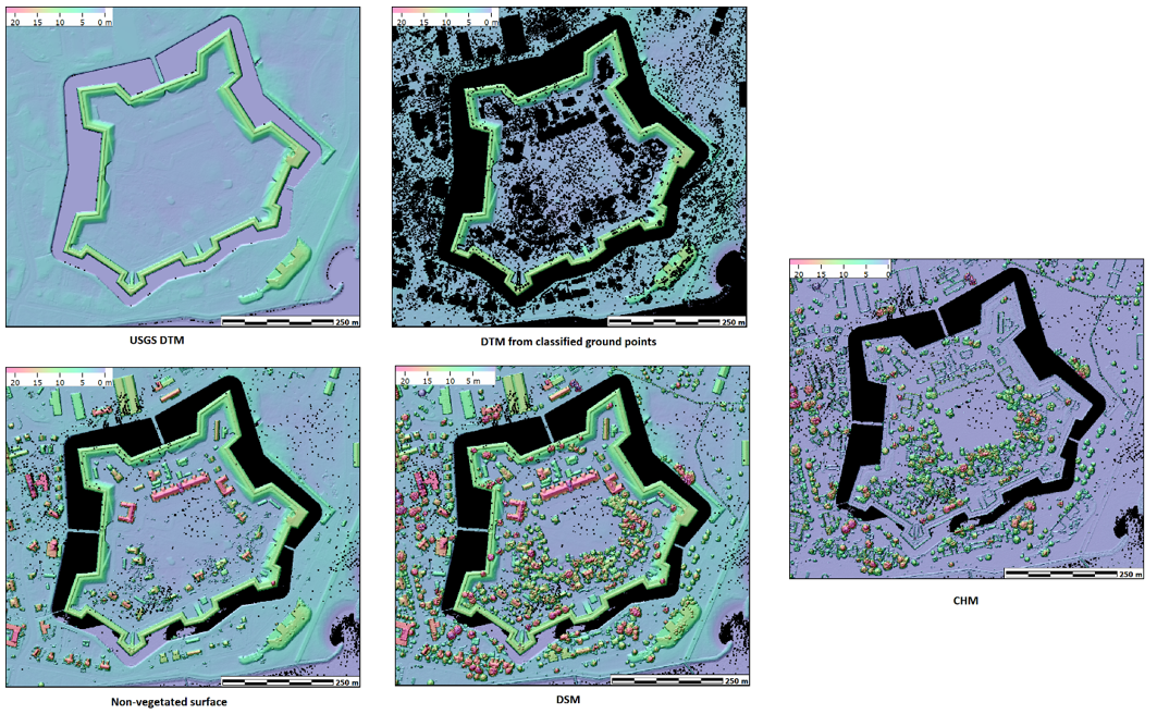
Lotniczy skaning laserowy (podstawy, plan lotu, podstawowe produkty ALS)
-
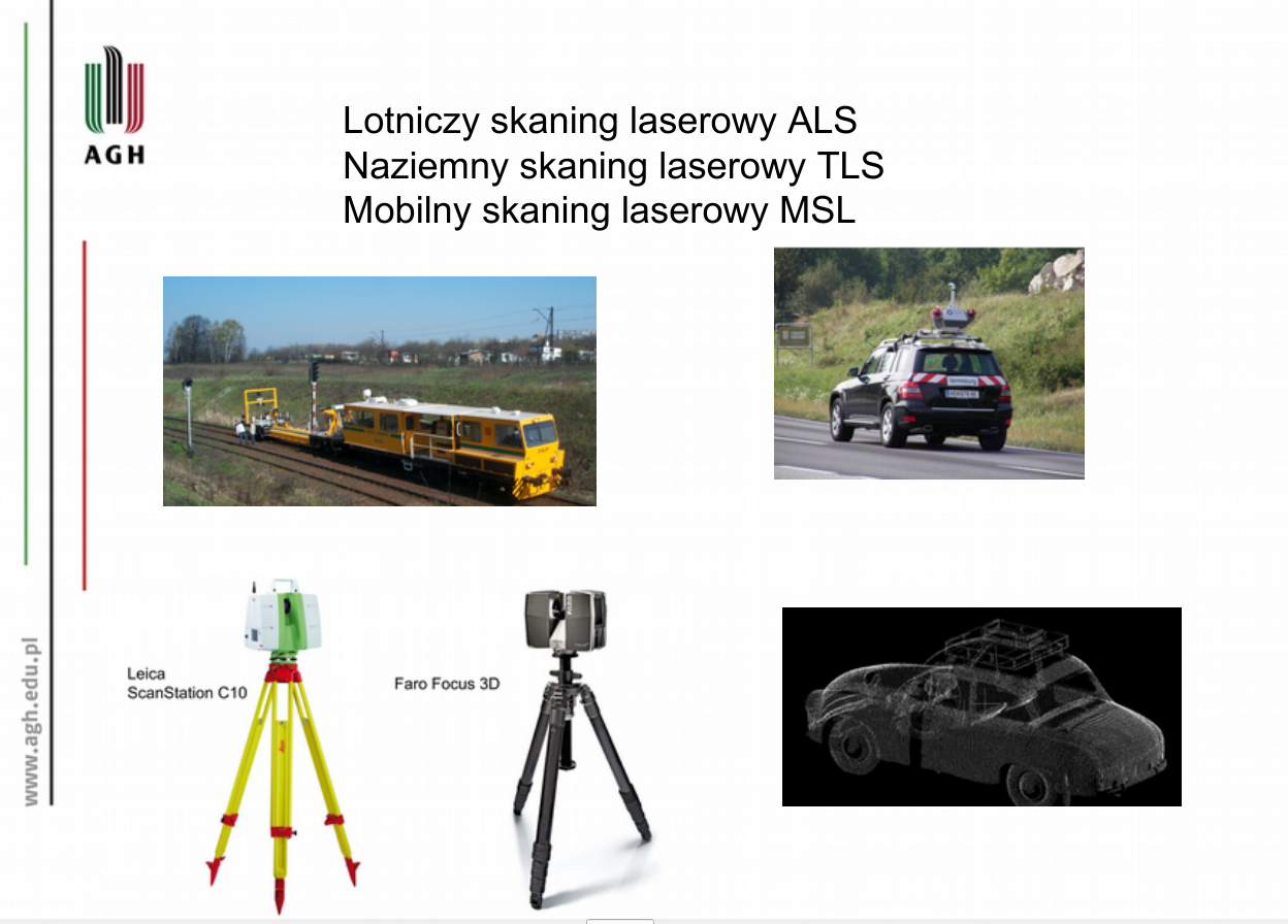
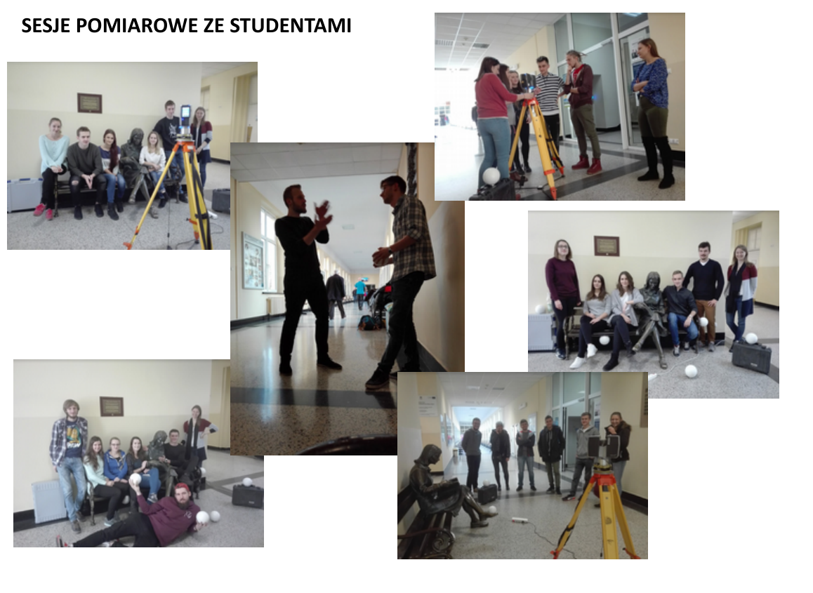
Naziemny skaning laserowy
-
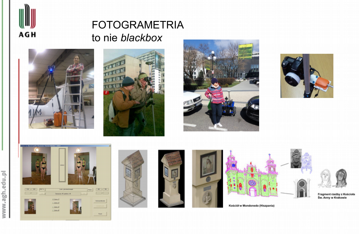
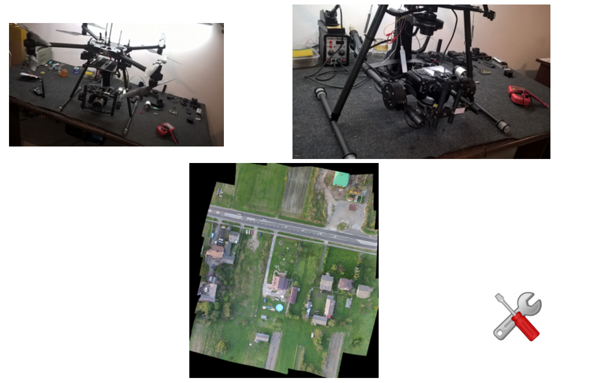
Fotogrametria bliskiego zasięgu
-
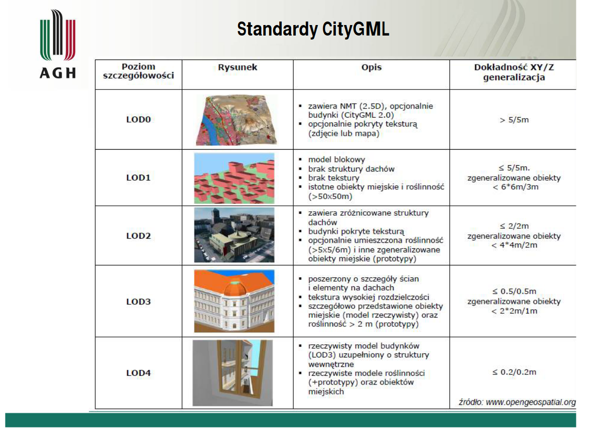
Modelowanie (budynków, obiekty 3D)
Semestr 7 Blok modułów specjalizujących: GIS 4D
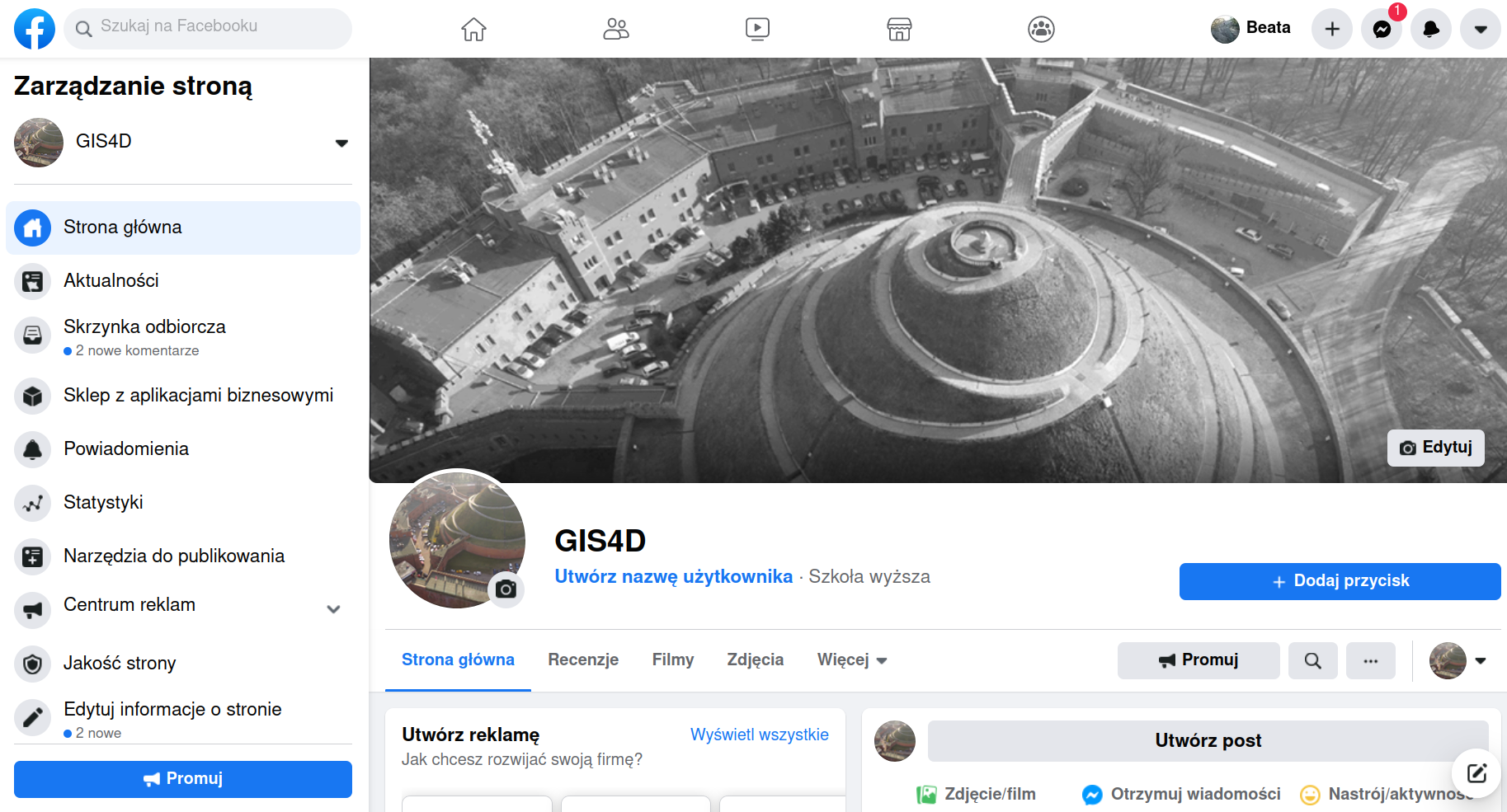
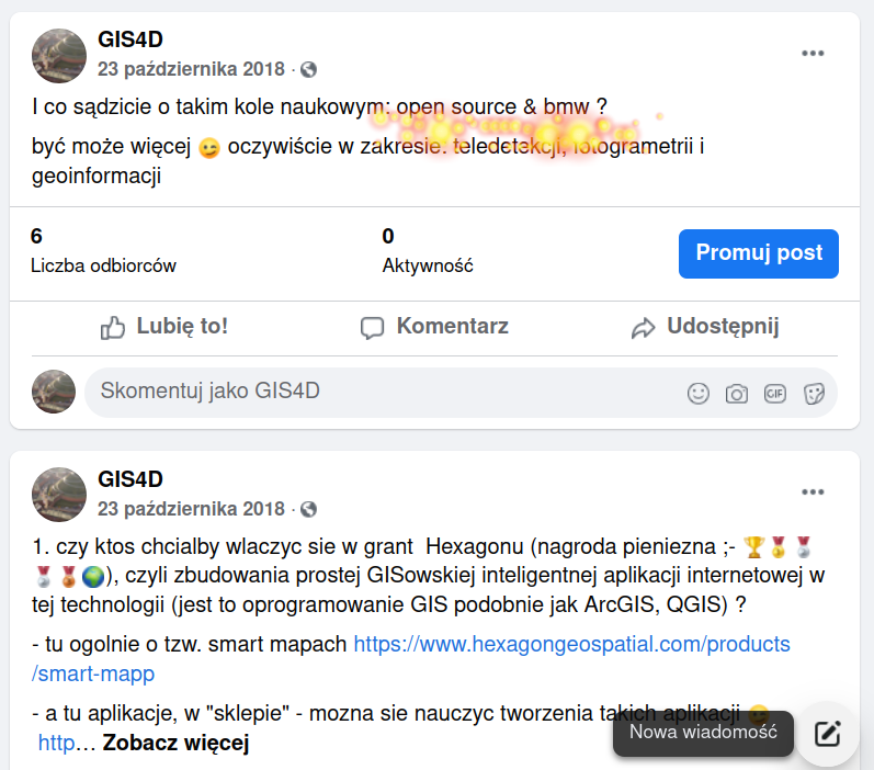
GIS 4D Facebook
Wizualizacje w internecie z wykorzystaniem darmowego narzędzia ESRI CityEngine
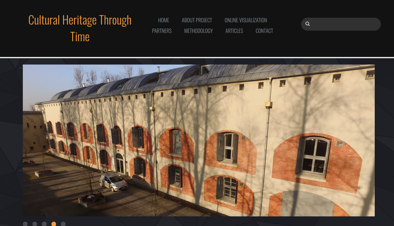
Cultural Heritage Through Time
Kopiec Kościuszki - movi
English
Blok modułów obieralnych w języku obcym
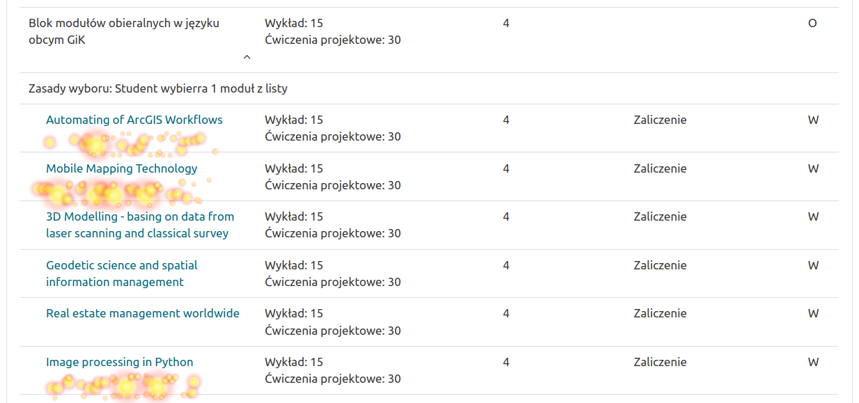
Automating of ArcGIS Workflows
Mobile Mapping Technology
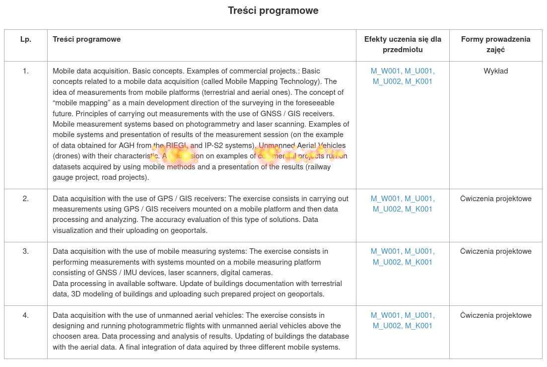
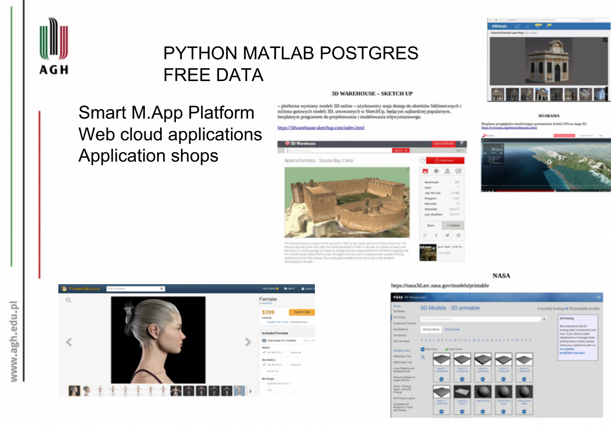
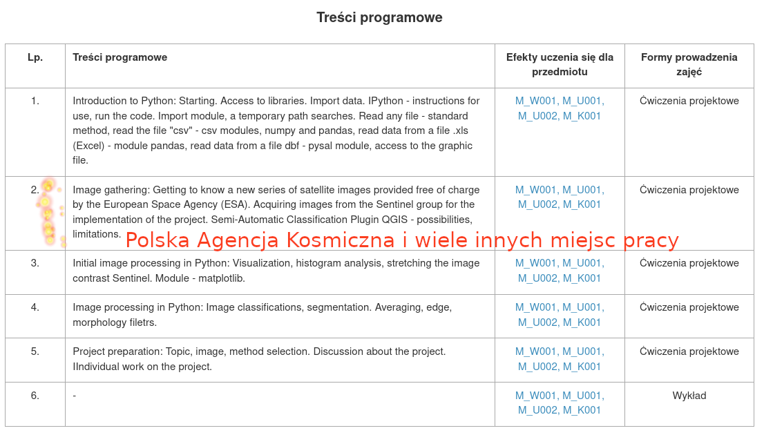
Image processing in Python
open source & bmw ;-)
co o tym sądzice ????
Specjalność GFiT po polsku na GIK
Remote Sensing and GIS po angielski na GIN
Projekty inżynierskie
COVID :-(((
Pasterczyk D., Polak R. 2018 Wspomaganie projektowania linii metra w Krakowie w oparciu o narzędzia GIS i CAD
Kłak D. 2020 Zastosowanie technik teledetekcyjnych i narzędzi GIS w wyznaczeniu lokalizacji inwestycji wraz z wizualizacją optymalnego wyniku
PROLOG
Zachęcam do korzystania z materiałów dydaktycznych


