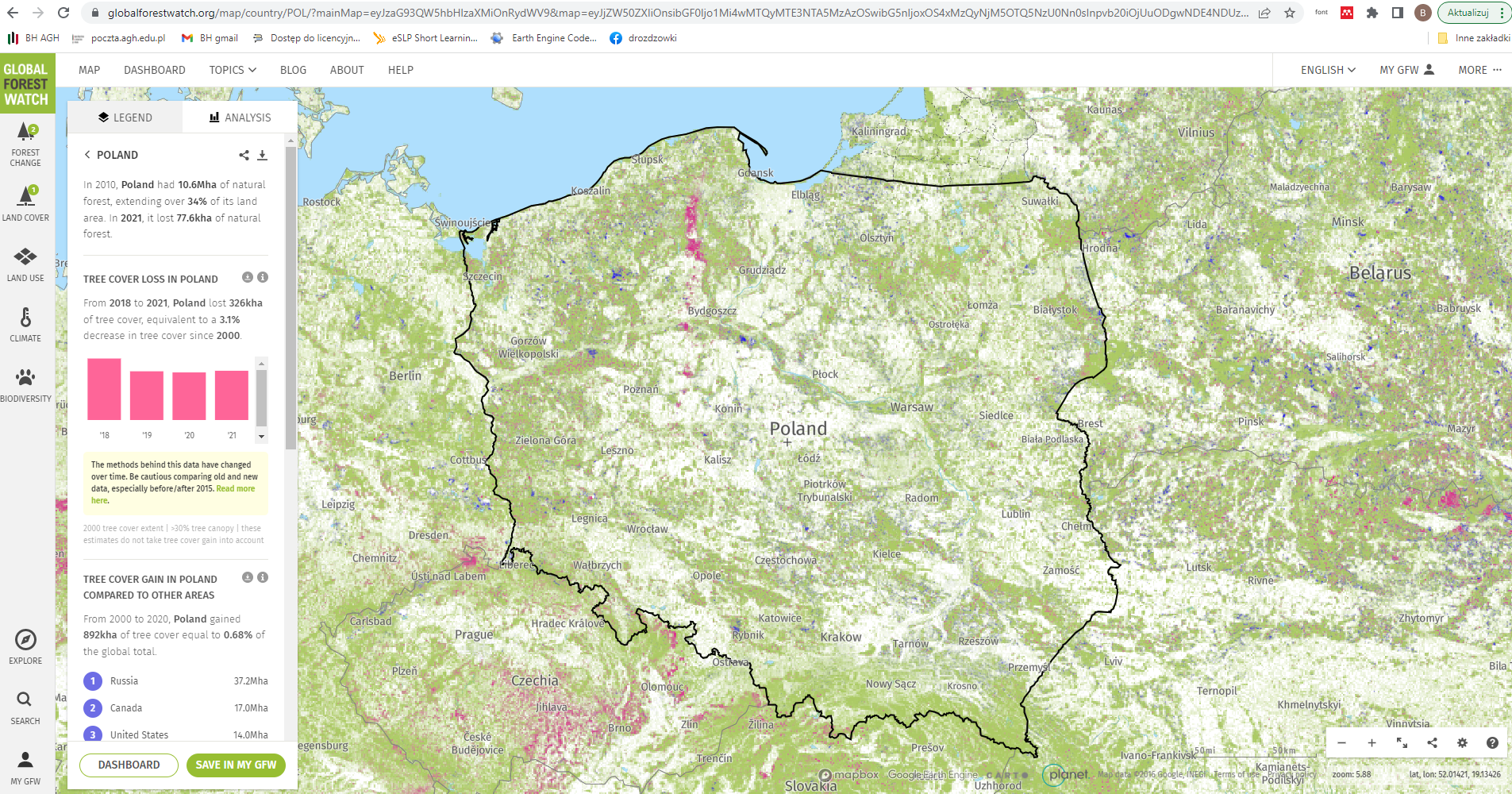
This is the first map of forest change that is globally consistent and locally relevant. What would have taken a single computer 15 years to perform was completed in a matter of days using Google Earth Engine computing.
The first detailed maps of global forest change
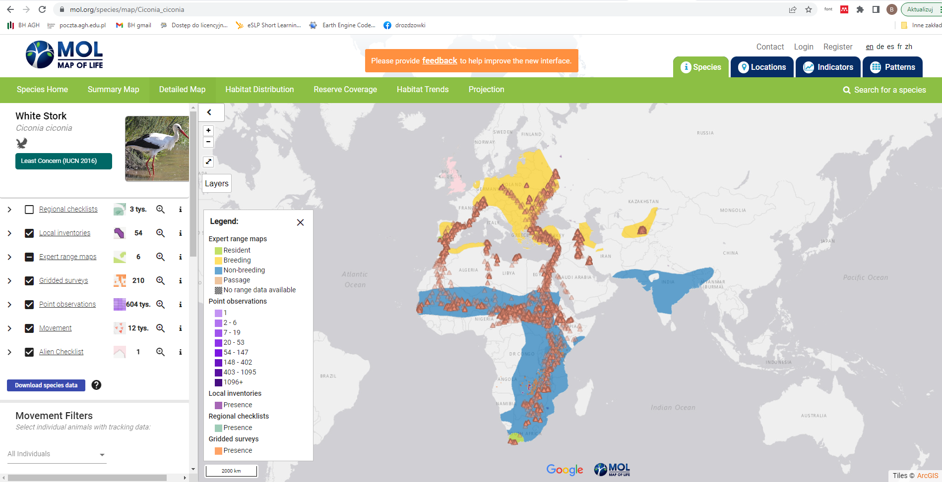
Earth Engine's scalable and cloud-based technology helps us deliver vastly improved estimates about the status and trends of tens of thousands of species to users in science, conservation and policy anywhere in a visual and interactive way.
Map of Life - biały bocian, white stork (C. ciconia)
Google Earth Engine has made it possible for the first time in history to rapidly and accurately process vast amounts of satellite imagery, identifying where and when tree cover change has occurred at high resolution. Global Forest Watch would not exist without it. For those who care about the future of the planet Google Earth Engine is a great blessing!
Collect Earth is a game changer – thanks to Google Earth Engine, we will be able to monitor the world’s forests much more efficiently together with all other actors.
Collecte Earth see: Tutorials - Key features
dostępność gotowych aplikacji - Examples
Image: Normalized Difference, Expression, Canny Edge Detector, HSV Pan Sharpening, Hough Transform
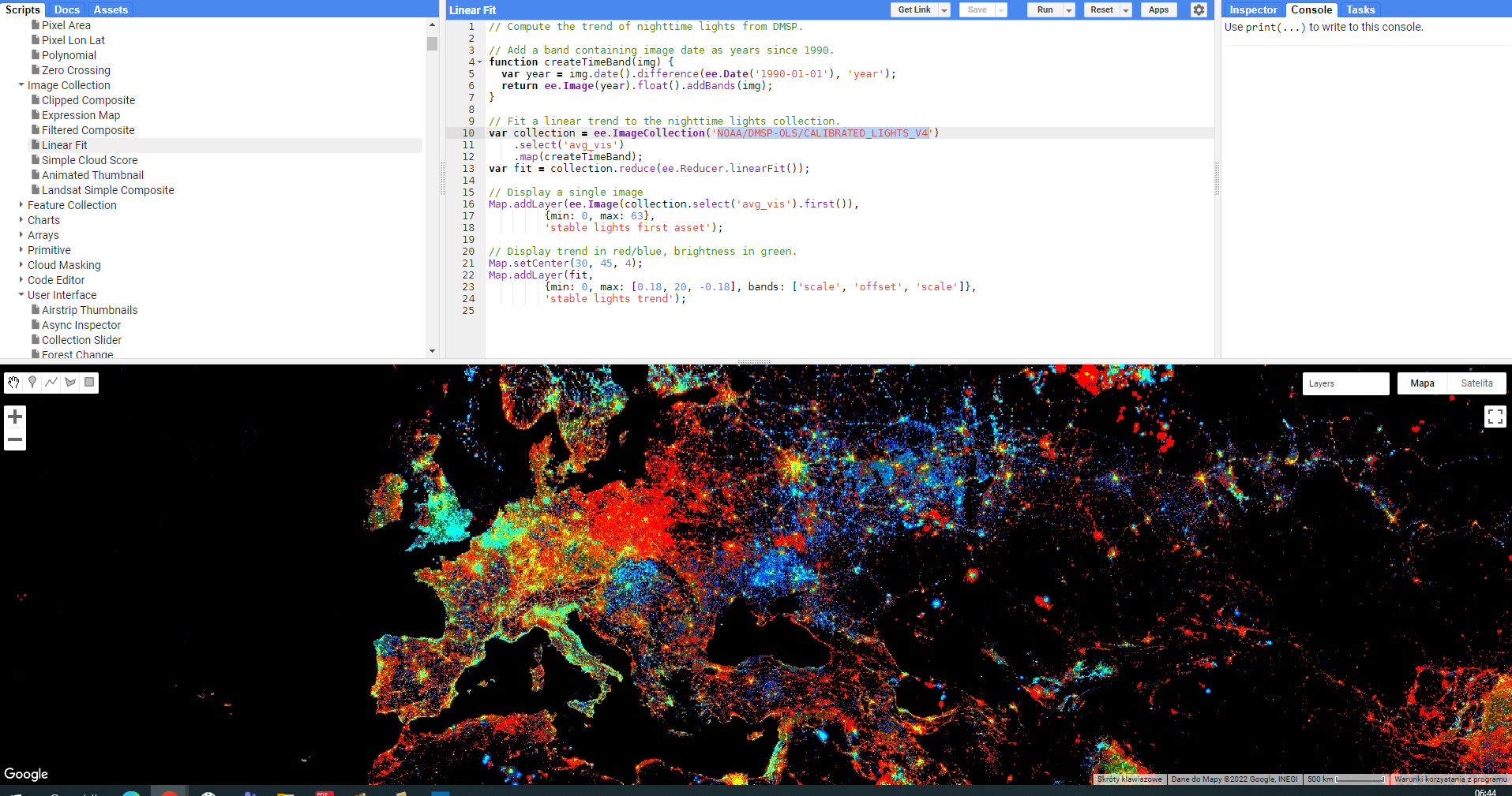
Image Collection: Linear Fit
Feature Collection: Buffer, Distance.....
Charts: Elevation Histogram, Elevation Profile, Image TimeSeries by Region, Seasonal Temperature, Elevation And Temperature
Arrays:.....
Arrays: Quality Mosaic (długo się generuje)
Cloud Masking: Landsat 8 Surfece Reflectance, Landsat8 TOA Refklectance QA Band
Demos: Terrain Visualization...